Showing posts with label South Island. Show all posts

Friday, June 6, 2008

How much for the whale?

If you get into a boat in Kaikoura and head East for just a few minutes, you will go over the edge of a vertical cliff with a drop of about 800 meters. The drop leads down further to a canyon 1300m at its deepest point. Within easy sight of the shore, you are off the continental shelf and into deep ocean water. The combination of the deep canyon and the intersection of two opposing ocean currents in these waters, brings nutrient rich deep-water closer to the surface, creating an ecosystem all of its own. The krill and plankton attract the fish, the fish attract the squid, the squid attract the whales and the whales attract the tourists.

They used to attract the whaling industry of course, but in New Zealand that all came to an end at the end of the 1970s. Apart from the ecological considerations behind the decision to ban whaling in NZ waters, the economic results are interesting. Whales in Kaikoura are like the trees on Fraser Island in Queensland, in that they are worth more alive than dead. The tourist industry here in New Zealand isn't just about bungy jumping and tequila slamming. It's about hiking through nature reserves and observing wildlife in its natural context. Conservation-based tourism is big business. Just about every reserve or animal encounter we have seen on the South Island is in private hands, and in each case the result of tourism is increased stocks and greater understanding of the creatures in question. The inclusion of wildlife in the global money-go-round seems to be working to the mutual benefit of economy and ecology alike. Economic pressures tend to operate in favour of conservation at the moment, but what happens in the case of a downturn?

Take the yellow-eyed penguins we saw on the Otago Peninsula. They are the rarest penguins in the world and their fate is now inextricably linked to the bottom line in the privately-owned Penguin Parade, and by extension to the global human economy. In this case, Penguin Parade isn't just an organization that brings you to see the animals in their natural environment, they are the animals' landlords. They own the patch of land that is the Yellow-Eyed Penguins' remaining breeding colony. Any number of international conservation charities would happily contribute towards the stabilization of Yellow-Eyed Penguin numbers, but Penguin Parade prefers NOT to take their money in order to continue running the business as they see fit. To be fair, they put their money into replanting the tree and shrub cover whose loss originally led to the dwindling number of this rarest of penguins. But if Penguin Parade ever goes out of business (perhaps tourist numbers will drop in the future thanks to increasing costs in flying?) then the penguins are on their own again. Or worse - evicted from their only remaining habitat in order for that land to realise a greater economic value. Many want to see the environmental cost of flying reflected in the cost of airfares. But economies can be as complicated as ecologies, and one side-effect of this move might be the collapse of global wildlife-based tourism, with consequent collapses in conservation efforts. I have no idea of course - I'm just speculating.

But I wasn't thinking any of these things on Thursday morning as we motored out of South Bay, and off the edge of the continental shelf, with the privately-owned Kaikoura Whalewatching company. All I was interested in was seeing some whales, and I got what I wanted. In two hours on the water we had three close encounters with Sperm Whales. The way we used to find them was the same hunting technique as formerly used by whalers. These mammals are deep divers, resting at the surface to breathe for 10-15 minutes, re-oxygenating their muscles, before diving for 30-40 minutes. They announced ithemselves with 2-meter spumes from their blowholes, giving us time to race over to them to watch their heads and torsos bob above the surface for a short while. Then finally, as they began their next dive, they lifted their powerful tails gracefully above the waterline, sinking out of sight and leaving a growing circle of flat water known as the whale's footprint.
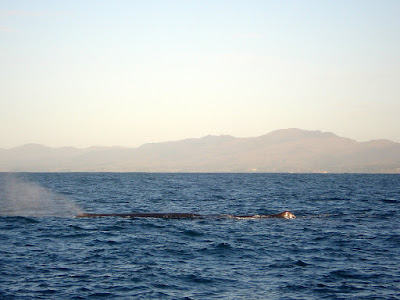
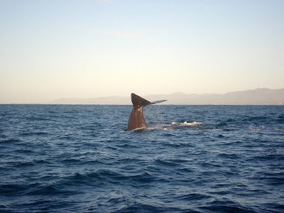


When we drive along a coast road, we mistake the sea for its surface, and consider the waves and swell to be all there is. For the Sperm Whale, the surface is the place where it spends the least time, the place where it comes by necessity rather than choice. It's nothing more than a filling station. A necessary but inconvenient stop to fuel its deeper activities. It is also the interface where man and whale interact, where the whale becomes an agent in the human economy. I hope that its market as a target for the camera-shutter rather than the harpoon remains viable.

Friday, May 30, 2008

Punakaiki

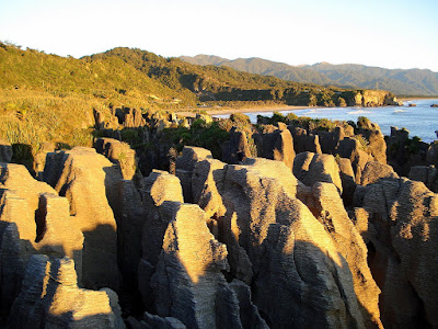
We packed our gold mining gains, and a souvenir pan (you never know) from Shantytown into the car, and continued northwards towards Greymouth and ultimately Punakaiki. This place is famous for its pancake rocks and its blowholes. The pancake rocks are a cliff formation peculiar to the area, formed underwater by marine animals obligingly turning into layers of limestone, sequentially and over a period of tens of millions of years. The finished product was thrust out of the sea by an earthquake, to form cliffs. The blowholes are holes (unsurprisingly) in the pancakes through which large volumes of liquid (maple syrup say, or perhaps just seawater) are squeezed at high tide. You can just see why people flock here. Just.

Punakaiki was the only other stop off on the West Coast that we thought was within easy striking distance and even vaguely interesting. Our expectations weren't high, and in one important way they were met: The food west of the Alps continued to disappoint. Had we eaten some of the pancake rocks themselves, rather than the disagreeable stodge for which we exchanged perfectly good real money in Punakaiki's only tavern, we would have been no worse off. If this is what the locals themselves regularly eat then clearly there is another variety of blowhole here whose eruptions are independent of the tide.

But all that was to come later.

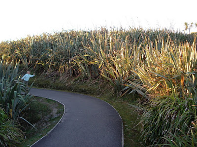
When we first arrived, we went straight to the rocks, and took the path that led in a circuit from the main road to the cliffs, through abundant flax growth, and back. It was close to sunset and Letizia started snapping away in light that perfectly displayed the strange formations. There was something strange in the atmosphere that at first I put down to the rocks themselves, the noise of the waves' impact underneath us, and to the isolation lent by the surrounding flax.


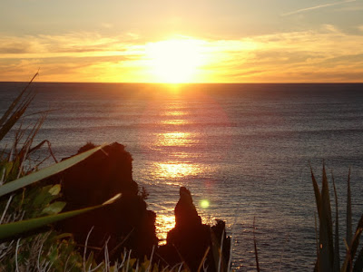
But after the light had faded and we had found our motel - situated on a tiny sliver of land with the darkened beach on one side and an even darker enormous cliff on the other - I realised what it was that had struck me as odd earlier on. Since leaving Cork, we've either travelled inland, or on the eastern seaboards of enormous landmasses. This family of islanders had just seen a sunset over the sea for the first time in 5 months.

Tuesday, May 27, 2008

Flash in the Pan

We stayed a second night in the Glowworm cottages, and already traumatized by the truely awful food available in the local pubs, we decided to play it safe and 'take the soup' on offer from our hosts, and hang out in the lounge for the evening. The next morning we headed back north again on our way to Punakaiki - home of pancake rocks and blow holes (what now?)

But before arriving there, we stopped off in a place called Shantytown, just outside of Greymouth. Shantytown is a reconstruction of a goldmining town. So much of white New Zealand history is bound up with this metal. It's discovery secured the future of the then-colony, attracting tens of thousands of prospectors from all over the world. The most exciting activity in Shantytown by far (even more exciting than the ham and cheese sandwiches) was panning for gold. Here, you are guaranteed a find. You're given a pan with stone and a very small amount of real gold, and instructions on how to pan. I was helping Nina and Sara (by edging them out of the way in order to make sure that they didn't lose whatever miniscule amount was in the pan) and discovering how unnervingly addictive it could be to stare into a pan of gravel, looking for flashes of gold.

The place was very quiet - it is off season - and felt all the more twee for the lack of crowds. There was a ride on a steam train which went all of 100 meters in one direction, before reversing back again.

I'd like to say that 5 months on the road has raised Nina and Sara's expectations and standards when it comes to entertainment. But it hasn't - they loved this place. To be fair to them, they loved the fact that the found gold and got to take it away with them. And I suppose to be even fairer to them, deep down I really like that they can enjoy a place like this without turning their noses up at it.

Interestingly enough, when we were there we met a lady from Clare (where my dad is from) who lived in the UK now but who had a niece in Carrigaline (where we call home). So if you're from Carrigaline, and you have an auntie Bridie (who's married to a kiwi) - she says to say hello!

Monday, May 26, 2008

Walking on Water

We shouldn't be let mind a dog, never mind two children. The night before our planned excursion on Fox Glacier, Sara gave her unsolicited opinion on the food in Arthur's Pass in the direct and physical way that we are used to from the girl: she barfed it all back up before bedtime. It wasn't looking good for the hike. To make matters worse - much worse - the following morning as we got up early and started to prepare ourselves the same child pointed out, again in the most direct way possible, that her stomach was empty and her sugars were low, by fainting in the bathroom. She didn't black out, but she ended up on her arse, murmuring slowly to herself, until we set her on the bed and put her head between her knees. Really - if anyone feels like reporting us, I'd almost encourage them.

But it gets worse again. Sara recovered quickly, and protested our decision to call off the glacier trip. She insisted that she wanted to do the hike and that she was fine now. We weren't buying it but set off to Fox Glacier (half an hour's drive from Franz Josef) to see if we could get a refund of the $100 deposit. When we got there, and explained Sara's alternating puking and swooning, Malcolm our guide-to-be told us that she'd be fine (these Kiwis are as good as the Aussies at shrugging off illness, danger and common-sense).

So, responsible parents that we are, we continued to increase Sara's sugar levels using fruit sweets and juice, fitted herself and Nina out with boots, and got on the bus with the guides that led to the start of the trail.

What's a glacier anyway?, I hear you ask (admittedly over the noise of those baying for our children to be removed for their own safetly). It's a river, really, that moves 100,000 times slower than normal rivers. Instead of water, flows ice. Instead of a spring, there's a snow-collecting basin (called a neve) over 3000m up the mountain, where today's snow compacts yesterday's and eventually compresses it into ice. The ice flows downhill under its own weight, moving on a layer of water formed where the ice meets the underlying rock, but also moving internally, in a plastic flow. At the bottom of the glacier, the terminal, where the higher temperatures defeats the pressure, the ice finally melts and runs off as cloudy green streams.

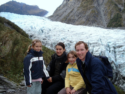
The way you get up onto Fox Glacier is to start near the terminal of the glacier and hike for the best part of an hour along the mountainside - the bank of this river of ice - until you reach a point where it's safe (in the I-have-signed-a-waiver sense of the word) to move onto the glacier itself. To reach this point, we had to climb a fair bit, as well as move along a narrow trail at the edge of a bluff. This last fact might alarm American or Antipodean readers. That's because they know what the hell a bluff is. A bluff in European English is a clever card-playing pretence, and very little else. So when we were told in advance that we would be walking along a bluff, I thought it odd but not much odder than anything else I've been told by a guide in the last 5 months. Halfway along our hike to the edge of the ice, we found out what a New Zealander means by a bluff. A bluff, so far as I can now tell, is a f**king great cliff with a 100m drop. It has a path alongside whose width is very much economy class. And by way of support for those who might have fainted that morning there is a chain and a red-bearded, grinning guide. (Social services numbers are in the Government section of the phone book, if you haven't found it yet).

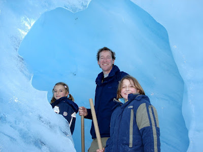
We survived, and not having been killed are of course stronger (big chunks of ice bring out the Nietzsche in me). Nina and Sara dealt with the heights like two little girls who know what it feels to zip along on a flying fox at 7 meters, and we all went on to have a surreal and rewarding experience walking on top of a glacier for 90 minutes or so.

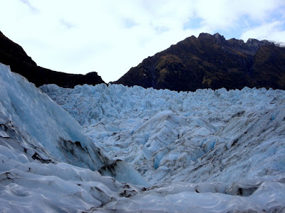
When we got to the edge of the glacier, we were handed poles, and told to put on our instep crampons. And then we walked on water. We stepped onto 12km of frozen but moving water. The surface was broken in a thousand different ways. Where it met the mountainside, it thrust upwards, trying to burst its banks. The centre of the flow moves faster than the edges, creating crevasses whose depths are disguised by the pools of water that fill them. We were walking in the melt zone of the glacier, where the liquid flow created other perfect imperfections on the icescape - archways, circular pools and waterfalls. From the mountain, the uppermost surface of the glacier is undulating but looks smooth. Up close, it is anything but. The ice looks like a snapshot of the choppy surface of a lake on a windy day.

On any trip, there are inevitably things that you wish you had kept your wallet closed for. You're probably glad you did them but you wished you didn't have to pay so much for it. We spent less than 100 euro in the backpackers in Franz Josef, and a little over 100 euros for the half-day trip on the Fox glacier. It was one of the best value highs we've had on the trip so far. If you come here with kids, be aware that there is practically nothing else to do in either Franz Josef or Fox Glacier. The evening activity is limited to going to the pub, and apparently they get quite boisterous. Our irresponsibility as parents doesn't extend to finding out in person.

Honest!!


Friday, May 23, 2008

West over Arthur's Pass

For the first time in quite some time, this blog is coming to you live. I've paid my blog debt and now I'm reporting directly from Franz Josef on the West Coast of New Zealand's South Island.

We stayed put in Christchurch for almost 2 weeks, but we couldn't resist any longer. We got into the car this morning and headed over the Arthur Pass. We've been looking west to the distant Alps since we first arrived in Christchurch, but it was only today that we pointed the car that way. After about 5 minutes in the car I mentioned to Letizia that finally being on the move again felt good and in fact moving has become our natural state of being. Staying put, even just for a week or two, was starting to weigh us down.

From coast to coast it's only a little over 200km. The first 70 kms were on the Canterbury Plains, flat and straight, with the foothills of the Alps appearing out of the mist. The second 70km was spend riding out of one valley and into another, each one different to the last. Some were tiny patches of fertile land, perhaps with a lake, others were stony flat badlands, others again with forests, until we reached Arthur's Pass. The rest of the trip to the coast was a steep and scenic descent to the sea. We turned south, lush treefern forests to our left, and the waves of the Tasman to our right. We were heading down to see the glaciers - and walk on them too. From start to finish we didn't pass anything approaching a large town. There were a dozen or more small towns, or collections of houses offering fruit, art or B&B. One sign advertised psychic readings and vegetable soup - an unusual combination that somehow seemed to work (something fulfilling, that also leaves you feeling full).

Our base for the next two nights is a small, cozy and cheap place called Glowworm Cottages in the centre of Franz Josef. For a room with four bunks, a kitchenette and an ensuite the total price for the 2 days comes in just under 100 euros. After that we'll head back up North to check out the Pancake Rocks, do a little panning for gold, and hopefully have the time and weather to check out the Devil's Punchbowl (thanks for that tip, Paul C).

Franz Josef was our first choice for a glacier walk, but unfortunately there's an age/height limit that Sara couldn't quite pass, not even on her tippy-toes wearing a pointy hat. A little further down the road, Fox Glacier doesn't have such requirements. But apparently the hike that leads up to the ice itself presents its own challenges - narrow trails with steep drops for example. We'll see if the Adrenalin Forest experience has prepared Nina and Sara (and Letizia and me, for that matter).

The town of Franz Josef is probably a great place if you don't have kids, but the only thing to do around here other than climbing a glacier is going to the pub. I think (hope) the glacier experience will be a positive one, but if you come here with kids, don't stay more than one night.

More tomorrow, if we survive the hike on the ice.

Sunday, May 4, 2008

To Dunedin via the Catlins

We're just back from two nights in Hanmer Springs, but I'm still deep in blog-debt so I'll first describe the last stages of our tour of the southern part of the South Island.

Our constant companion on the new Zealand road is the circling bird of prey. If we were of a nervous disposition, we might have interpreted the wheelings overhead as a vote of no confidence in our ability to survive New Zealand's extreme sports (or indeed extreme driving). The reality is that these birds hover over the highway looking for 'squashums' (squashed possums) - it's easier to have your pick of animals already picked off by cares, than to hunt them down yourself.

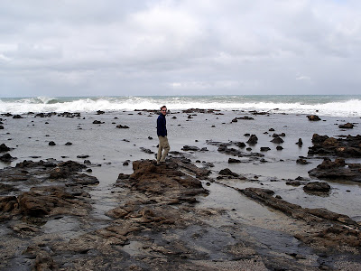
First stop was a fossilized forest lying in the intertidal region of Curio Bay, less than an hour from Invercargill. It sounded dramatic and had the added frisson that the tide had to be out in order to see it. Being a landlubber, I didn't even bother to check the tide times before setting off, happy to leave it all to chance. As chance would have it, we arrived just in time - in time to watch a powerful Pacific tide wash over a black, stump-pocked sheet of rock. The spectacle provided by the dangerously fast tide was more interesting by far than the fossilized tree stumps that we came to see. I can't imagine where the Pacific Ocean got its name. Seemed pretty angry about something from where I was standing.


After Curio Bay we moved to the nearby Slope Point, the South Island's most southerly point and our trip's lowest latitude. We were halfway round the world, and at our nadir, so it made sense to stop off for a coffee at the Nadir Outpost just set back from Slope Point.
"Do you do coffee?" I asked as we walked towards the entrance.
"Yes, come right in" the lady replied in an accent that sang gently in a way that no Kiwi or Australian accent can.
She brought us to the small and sparsely furnished front room of Nadir Outpost (itself just a little bungalow sharing its grounds with a few other low buildings) and disappeared to prepare the coffee and hot chocolate. By the time she got back I had understood where she was from.
"You're Welsh" I suggested.
"From South Wales, yes."
Interestingly specific. The last time I encountered a similar precision was in reading about Captain James Cook. Nobody is sure if in naming the East coast of Australia New South Wales he was merely pointing out the geographically obvious, or whether more pointedly he was deliberately snubbing the northern half of Wales. I've only been to North Wales once - an attempted cycle from Anglesey to Aberystwyth. I stopped off in a town with a generously long and unpronounceable name to ask directions. I wasn't so much rebuffed as contemptuously ignored - and I thought everybody loved the Irish (this was pre-Celtic Tiger). It might not have helped my case in approaching strangers in the street that I was wearing a pair of Lycra bicycle shorts long before Little Britain's only gay in the village made it either fashionable or profitable to do so. Whatever the reason, my experience leaves me happy to believe that Captain Cook, the man who added so much to the world's atlas had good reason to delete North Wales. Accordingly, I was happy for Beverly, the landlady of the Nadir Outpost to set matters straight on the precise nature of her Welshness.

Because I'm a nosey git, I learned more. Once upon a time she was married to a man who had no interest in travel (sound familiar?) When they eventually parted ways, she met Richard, who had also suppressed a desire to travel for the sake of his former partner. Within days of becoming a couple, they sent off an application to emigrate to Australia - almost without even having to discuss it, such were their shared assumptions on travel. They spent 7 years in Queensland, Australia before deciding to get out of the heat and move to New Zealand (mission accomplished - it was not warm at Slope Point!!) They had been there for 18 months when we met them. It's interesting to note that having children is not nearly as incompatible with travel as having a reluctant spouse is.

Next stop on the Catlins was a waterfall by the name of Purakaunui Falls. The last time we stopped the car to walk to a waterfall it was at the Kondalilla Falls in Queensland. On that occasion what started as a gentle amble finished under a cloudburst, sandals wedged with mud, and nothing but a pair of structurally compromised umbrellas that served more for comical effect - and perhaps as protection from falling leeches - than as a way to stay dry. The whose-idea-was-that silence in the car after Kondalilla was not something I wanted to repeat. And yet when the walk to Purakanui Falls turned out to be a brief and dry one, I couldn't help feeling that the overall impression it made was also brief and dry. I'm sure that when pleasant Purakanui is a long lost moment, catastrophic Kondalilla live on in the collective family memory. That's the nature of travel stories.

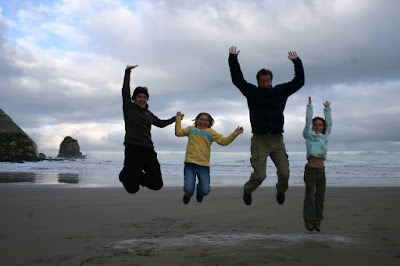
The last stop of the day was a place called Cannibal Bay. I've no idea where the place got its name - though it is a well-documented fact that the Maori practiced ritual cannibalism on their defeated enemies. Our hope for the place was to find some sea lions, or lions-of-the-sea as Sara was calling them under the influence of 5 days on the road with predominantly Italian spoken. Our hopes came to nothing alas, but our spirits remained inexplicably high:


We ran around the beach for a while, Nina keeping a watchful eye on the tall grass in the dunes where sea lions were reputed to hide. You don't want to get between a sea lion and the sea, by all accounts. We needed have worried.

We spent as much time off the main road as on it that day, having stopped off at many points of interest, and getting trapped behind at least two flocks of sheep (the latter opportunity giving me the opportunity to see just how unprepared that species is for a life without man - if we don't make it, sheep are next on the list). Catlins Coast box ticked, we packed into the car, and motored into the sunset towards Dunedin. More on that next.